
Quick Answer
It takes about 6 to 7 hours to drive across Kansas east to west on Interstate 70, covering roughly 424 miles from the Missouri border near Kansas City to the Colorado border. That is the pure driving time plus normal fuel and rest stops. If you drive non-stop at motorway speed, the same crossing takes about 5 hours 45 minutes, and if you stop to eat, stretch and see a sight or two, plan on 7 to 8 hours. Driving north to south is much shorter: about 3 to 4 hours on I-35, covering roughly 235 miles from the Oklahoma border to Nebraska. The scenic US-50 route across the state is longer, at about 458 miles, and takes 7 to 8 hours with stops.
Introduction
Kansas has a reputation problem with drivers. Ask anyone who has crossed it and they will tell you it is flat, empty and endless — a state you endure rather than enjoy. The truth is more interesting than the reputation, and the drive time is shorter than most people expect. At motorway speed, you can cross the entire state in a single morning, and if you plan it right, the crossing includes some of the most unusual scenery in the American Midwest: the last great stretch of tallgrass prairie in North America, chalk rock formations rising out of nowhere, and small towns that still look like the Old West.
This guide answers the question properly. You will get the drive time for every realistic route across Kansas — east to west and north to south — with town-by-town mileages and times, the fuel cost for the crossing, what the tolls actually are, how weather and wind change the trip, where to stop, and how to plan the drive so it feels like a road trip instead of a chore. Everything here is based on the real road network: I-70, I-35, US-50 and US-56, with distances measured along the roads themselves rather than guessed from a map.
How Long Does It Take to Drive Across Kansas? The Short Version
Most people asking this question mean the east-to-west crossing, because that is the long one and the one most cross-country drivers face. The table below gives the headline answer for every main route, before we get into the detail.
| Route | Direction | Distance | Driving time (no stops) | Realistic time (with stops) |
|---|---|---|---|---|
| I-70 | East–west | ~424 miles | ~5 hrs 45 min | 6–7 hours |
| US-50 | East–west | ~458 miles | ~6 hrs 30 min | 7–8 hours |
| US-56 | East–west (diagonal) | ~400 miles | ~7 hours | 8–9 hours |
| I-35 | North–south | ~235 miles | ~3 hrs 15 min | 3–4 hours |
| US-69 | North–south | ~268 miles | ~4 hours | 4–5 hours |
Two things stand out. First, the interstate is not just faster — it is dramatically faster than the scenic alternatives, because US-50 and US-56 run through small towns with lower speed limits and traffic lights. Second, the difference between “driving time” and “realistic time” is about an hour on the east–west crossing. Nobody drives 424 miles without stopping, and the drivers who plan for two fuel stops and a proper lunch break arrive far happier than the ones who try to do it in one heroic push.
The Main Route: I-70 East to West (424 Miles, 6–7 Hours)
Interstate 70 is the fastest and simplest way to drive across Kansas. It enters the state at Kansas City on the Missouri border and runs almost straight west to the Colorado border near Kanorado, passing through Lawrence, Topeka, Junction City, Abilene, Salina, Hays, Russell, WaKeeney, Oakley, Colby and Goodland on the way. The whole interstate section inside Kansas is about 424 miles long, and the speed limit is 75 mph on most of the rural stretches — the highest in the state.
I-70 Town by Town: Miles and Times
The table below breaks the crossing into legs between the towns you will actually pass. Mileages are approximate, measured along I-70, and the times assume motorway speed with normal traffic. Use it to plan fuel stops and to answer the eternal back-seat question of how much longer.
| Leg | Miles | Driving time |
|---|---|---|
| Kansas City → Lawrence | ~40 | ~35 min |
| Lawrence → Topeka | ~25 | ~25 min |
| Topeka → Junction City | ~55 | ~50 min |
| Junction City → Abilene | ~25 | ~25 min |
| Abilene → Salina | ~25 | ~25 min |
| Salina → Russell | ~75 | ~1 hr 5 min |
| Russell → Hays | ~25 | ~25 min |
| Hays → WaKeeney | ~35 | ~30 min |
| WaKeeney → Oakley | ~35 | ~30 min |
| Oakley → Colby | ~40 | ~35 min |
| Colby → Goodland | ~28 | ~25 min |
| Goodland → Colorado border | ~17 | ~15 min |
| Total | ~424 | ~5 hrs 45 min |
The longest single gap between proper towns is Salina to Russell, about 75 miles of open prairie. That is not a problem for fuel — there are service plazas and exits in between — but it is the stretch where the “endless Kansas” feeling is strongest, and where a full tank and a good playlist matter most.
Where to Stop for Fuel on I-70
Fuel is not a problem on I-70, but it is worth planning your stops rather than leaving them to chance. The practical fuel stops, westbound, are:
| Stop | Mileage from Kansas City | Why stop here |
|---|---|---|
| Topeka | ~60 miles | Last big city services before the long middle stretch; food, fuel and restrooms |
| Salina | ~175 miles | The natural halfway fuel stop; the biggest town in central Kansas |
| Hays | ~275 miles | Best food and fuel options in western Kansas; good place for a meal break |
| Colby | ~385 miles | Last full-service town before the Colorado border; top up here |
| Goodland | ~407 miles | Final Kansas stop; cheap fuel and a good place to stretch before Colorado |
A car with a 300-mile range can cross the state on a single tank with a comfortable margin, but most drivers stop twice: once around Salina and once around Hays or Colby. If you are driving at night, fill up at Hays — the stretches west of Hays have fewer 24-hour stations, and some small-town stations close early.
North to South: I-35 (235 Miles, 3–4 Hours)
Crossing Kansas north to south is a much shorter drive, and it catches a surprising number of people out because they assume it will take as long as the east–west crossing. It does not. Interstate 35 runs from the Oklahoma border near South Haven to the Nebraska border near Belleville, a distance of about 235 miles, and the drive takes 3 to 4 hours including stops.
| Leg | Miles | Driving time |
|---|---|---|
| Oklahoma border → Wichita | ~45 | ~40 min |
| Wichita → Emporia | ~60 | ~55 min |
| Emporia → Topeka | ~60 | ~55 min |
| Topeka → Nebraska border | ~70 | ~1 hr |
| Total | ~235 | ~3 hrs 15 min |
The southern half of this route is the Kansas Turnpike, which is a toll road — see the tolls section below. The main thing to know about the north–south drive is the traffic: the stretch between Wichita and Kansas City carries heavy commuter and freight traffic, and the last 30 miles into the Kansas City area can take as long as the first 100 miles if you hit it at rush hour on a weekday afternoon. The Flint Hills between Emporia and Cassoday are the scenic highlight of the whole route, and one of the last remaining stands of tallgrass prairie in North America.
The US-69 Alternative
If you want a slower, quieter north–south crossing, US-69 runs roughly parallel to I-35 through the eastern side of the state, from the Oklahoma border to the Nebraska border, at about 268 miles. It takes 4 to 5 hours because it passes through small towns with lower speed limits, but it is a more pleasant drive if you are not in a hurry, and it avoids the Turnpike tolls entirely.
The Scenic Routes: US-50 and US-56
Not everyone crossing Kansas is in a hurry, and the two scenic alternatives are genuinely better drives — they just take longer.
US-50: The Santa Fe Trail Route (458 Miles, 7–8 Hours)
US-50 follows the old Santa Fe Trail corridor across the state, from Kansas City in the east to the Colorado border near Coolidge in the west, passing through Ottawa, Emporia, Hutchinson, Dodge City and Garden City. At about 458 miles it is roughly 35 miles longer than the I-70 crossing, and the slower speed limits through dozens of small farming towns add at least an hour. Plan on 7 to 8 hours with stops.
What you get for the extra time is the real Kansas: the agricultural heart of the country, where much of the wheat that becomes American bread is grown, and towns like Dodge City that still trade on their Wild West history. The route also passes near Fort Larned and Council Grove, two of the best-preserved Santa Fe Trail sites in the country. If you have a day to spare, US-50 is the better trip. If you have a schedule to keep, it is not.
US-56: The Diagonal Shortcut That Is Not a Shortcut (About 400 Miles, 8–9 Hours)
US-56 cuts diagonally across Kansas from the Oklahoma border in the south-east to the Colorado border in the west, and on a map it looks like the shortest way across the state. In practice it is the slowest, because it is a two-lane road for much of its length, running through small towns with 30 and 45 mph limits. Drivers who have done it report 8 to 9 hours for the crossing, and it is best treated as an experience rather than a route — a long, straight meditation on the prairie rather than a way of getting somewhere quickly.
What Affects Your Drive Time
The headline times above assume normal conditions. In practice, five factors decide whether your crossing takes six hours or nine.
1. Speed Limits
Kansas speed limits are generous by American standards, and they are the single biggest reason the crossing is as quick as it is. The limits that matter:
| Road type | Speed limit |
|---|---|
| Rural interstate (I-70, I-35 outside cities) | 75 mph |
| Urban interstate (Kansas City, Wichita, Topeka) | 65 mph |
| Rural divided highways | 65 mph |
| Two-lane rural highways (US-50, US-56) | 65 mph |
| Small towns on US routes | 30–45 mph |
Speed limits drop sharply in small towns on the US routes, which is why US-50 takes so much longer than I-70 despite being only 35 miles longer. On the interstate, the 75 mph limit is real, but so is the wind — see below.
2. Wind
Kansas wind is not a joke, and it is the factor most out-of-state drivers underestimate. The state sits in the middle of the Great Plains with almost nothing to break the wind, and sustained winds of 20 to 30 mph with gusts over 40 mph are common, especially in spring and autumn. A strong crosswind will not slow you down much, but it will tire you out, push a high-sided vehicle around, and make the drive feel twice as long. A strong headwind can cost you 5 to 10 mph of real speed and noticeably more fuel. If you are towing a trailer or driving a tall vehicle, check the wind forecast before you leave — the Kansas Department of Transportation issues wind advisories for the I-70 and I-35 corridors, and they are worth taking seriously.
3. Weather and Seasons
Kansas weather changes fast, and each season has its own way of slowing you down.
| Season | What to expect | Time impact |
|---|---|---|
| Winter (Dec–Feb) | Snow, ice and blizzard conditions, especially in western Kansas; I-70 can close | Hours, or an overnight stop |
| Spring (Mar–May) | Thunderstorms, hail and tornado season; heavy rain | 30 min–2 hours |
| Summer (Jun–Aug) | Heat, occasional severe storms, road construction season | 15–60 min |
| Autumn (Sep–Nov) | The best driving season; harvest traffic on rural roads | Minimal |
Winter is the only season that can turn a six-hour crossing into an overnight stay. Western Kansas gets genuine blizzards, and when the wind drives snow across the open prairie, visibility can drop to zero in minutes. If a winter storm warning covers your route, do not try to outrun it — the Kansas Highway Patrol closes I-70 when conditions demand it, and being stuck in a closure is far worse than waiting it out in Hays or Salina. In spring, keep an eye on thunderstorm warnings and know that tornado watches are common; a tornado warning means pulling off and taking shelter, not driving through.
4. Traffic
Kansas is one of the least congested states to drive in, but traffic still matters in three places: the Kansas City metro area on the eastern end, Wichita on I-35, and the Topeka–Lawrence corridor on I-70. Weekday rush hours (7–9 AM and 4–6 PM) can add 30 to 45 minutes to the eastern end of an I-70 crossing, and a Friday afternoon in the Kansas City area can be slow for 20 miles. Outside those pockets, traffic is rarely a factor, and at night the interstate is almost empty.
5. Road Construction
Summer is construction season in Kansas, and the state rebuilds long stretches of I-70 a few miles at a time. A single work zone typically costs 10 to 20 minutes; two or three of them in one crossing can add an hour. Check the Kansas Department of Transportation’s KanDrive site or call 511 before you leave, and add a buffer to your plan in summer.
How Much Does It Cost to Drive Across Kansas?
The crossing is cheap by cross-country standards, because the distance is modest and the fuel is relatively inexpensive. The tables below use a planning fuel price of about $3.00 per gallon — check current prices before you go, as they move with the market.
Fuel Cost by Vehicle
| Vehicle fuel economy | Gallons for 424 miles | Fuel cost (at $3.00/gal) |
|---|---|---|
| 20 mpg (large SUV or truck) | ~21 gallons | ~$64 |
| 25 mpg (mid-size SUV) | ~17 gallons | ~$51 |
| 30 mpg (sedan) | ~14 gallons | ~$42 |
| 35 mpg (efficient sedan or hybrid) | ~12 gallons | ~$36 |
| 40 mpg (hybrid) | ~11 gallons | ~$32 |
For a round trip, double these figures. The US-50 route adds about 35 miles, which is roughly $3 to $5 extra in fuel depending on your vehicle.
Tolls: What You Actually Pay
This is the part most guides get wrong. Interstate 70 across Kansas is free — there are no tolls on the east–west crossing. The tolls in Kansas are on the Kansas Turnpike, which is the I-35 section between Wichita and the Kansas City area, plus I-335 and I-470 near Topeka and Wichita. If you are driving north to south on I-35, you will pay Turnpike tolls. If you are driving east to west on I-70, you will not.
The Turnpike is now fully cashless — there are no toll booths and no cash payments. Tolls are collected electronically, either through a K-TAG transponder, which gives the lowest rate, or by Toll-by-Plate, where cameras read your licence plate and a bill is mailed to the registered owner. A full Turnpike crossing costs a few dollars with a K-TAG and somewhat more by plate. If you are driving a rental car, check the rental company’s toll policy before you go, because some companies add a hefty daily fee on top of the toll itself.
Driving an Electric Vehicle Across Kansas
Electric vehicles can cross Kansas on I-70, but the trip needs more planning than the same drive in a petrol car. DC fast chargers are available in Kansas City, Lawrence, Topeka, Salina, Hays, Colby and Goodland, which means the gaps between chargers are manageable — the longest is roughly 100 miles, between Salina and Hays. The practical advice is simple: charge at Salina and again at Hays, and do not skip a charging stop to save twenty minutes, because the next charger is always further away than you think.
Two things make the EV crossing slower than the petrol crossing. First, each charging stop takes 30 to 45 minutes rather than the 10 minutes a fuel stop takes. Second, Kansas wind and winter cold both reduce range — a strong headwind or a freezing day can cut real-world range by 20% or more. Plan on 7 to 8 hours for the I-70 crossing in an EV, and check charger status on your route the morning you leave, because a single out-of-service charger in western Kansas can force a long detour.
The Best Stops on the Way Across
If you have time to stop, Kansas rewards it more than its reputation suggests. These are the stops worth planning around, in east-to-west order.
| Stop | Where | Why it is worth it |
|---|---|---|
| Tallgrass Prairie National Preserve | Near Strong City, south of I-70 | The last great tallgrass prairie in North America; hiking trails and bison |
| Eisenhower Presidential Library | Abilene | The presidential library and boyhood home of Dwight D. Eisenhower |
| Sternberg Museum of Natural History | Hays | One of the best fossil and natural history museums in the Midwest |
| Monument Rocks | Near Oakley | Chalk rock formations rising out of the plains; one of the 8 Wonders of Kansas |
| Dodge City | On US-50, south of I-70 | Wild West history, rodeos and the Boot Hill Museum |
| Fort Larned National Historic Site | On US-50 | A remarkably well-preserved 1860s frontier fort on the Santa Fe Trail |
| World’s Largest Ball of Twine | Cawker City, north of I-70 | Exactly what it sounds like, and a classic roadside photo stop |

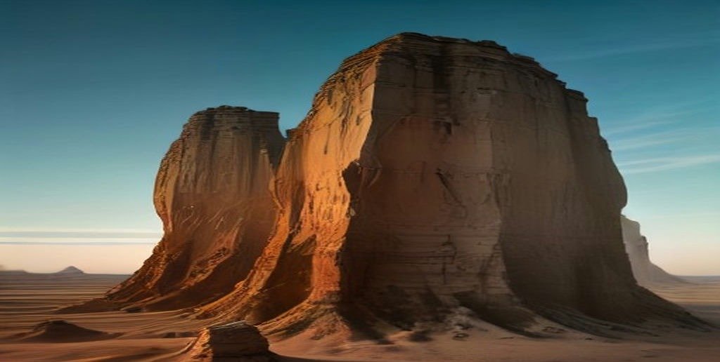
Monument Rocks deserves a special note: it is about 25 miles south of I-70 on unpaved roads, so it adds at least an hour to your trip, but it is the single most surprising sight in the state — 70-foot chalk towers in the middle of flat farmland that look like they belong in the desert Southwest. Go in the late afternoon, when the low sun turns the chalk gold, and check the road conditions first, because the gravel roads can be impassable after heavy rain.
Three Ways to Do the Crossing
The right plan depends on how much time you have. Here are the three trips most drivers actually take.
The Fast Crossing: 6 Hours
Leave Kansas City by 8 AM, drive I-70 west with one fuel stop at Salina and a quick lunch in Hays, and you are at the Colorado border by early afternoon. This is the plan for drivers who are passing through on a cross-country trip and want Kansas behind them. Total stops: two, totalling about 45 minutes.
The Scenic Day: 8–9 Hours
Leave Kansas City by 8 AM, take I-70 to Abilene for the Eisenhower Library, stop for lunch in Salina, detour to Monument Rocks in the afternoon, and reach the Colorado border by early evening. This is the plan for drivers who want to see something of the state without adding a day to the trip. Total stops: three to four, totalling about 2 hours.
The Two-Day Trip: US-50 and the Santa Fe Trail
Day one: Kansas City to Dodge City on US-50, stopping at Council Grove and Fort Larned, overnight in Dodge City. Day two: Dodge City to the Colorado border, with a morning at the Boot Hill Museum. This is the plan for drivers who want the real Kansas rather than the interstate version of it, and it is the only one of the three that feels like a holiday rather than a drive.
Planning Checklist
Before you set off across Kansas, run through this list. It takes five minutes and prevents most of the problems that slow drivers down.
- Fill up before you leave Kansas City or Wichita. Fuel is cheaper in the cities than at the small interstate exits.
- Check KanDrive (the Kansas Department of Transportation site) or call 511 for closures, construction and weather.
- Check the wind forecast. Sustained winds above 25 mph make the drive tiring and cost fuel, especially in a tall vehicle.
- Download offline maps. Mobile coverage is good on the interstates but patchy on the US routes and in the Flint Hills.
- Carry water and snacks. The gaps between services are long in western Kansas, and in summer the heat is serious.
- Know your range. If your vehicle does less than 250 miles per tank, plan fuel stops at Topeka, Salina and Hays — do not skip one.
- In winter, carry a blanket, a torch and a charged phone. If I-70 closes in a blizzard, you may be waiting a while.
Common Mistakes Drivers Make
Underestimating the wind. Drivers from the east coast arrive expecting a flat, easy drive and discover that a 30 mph crosswind makes a 400-mile day genuinely exhausting. If you are towing anything, the wind is the first thing to check.
Trying to do it without stopping. Six hours sounds short until you are four hours in with two hours to go and no towns in sight. Two proper breaks make the trip faster in practice, because a tired driver is a slow and dangerous driver.
Skipping fuel in western Kansas. The towns are further apart than they look on the map, and the stations in the smallest towns are not all open 24 hours. Fill up at Hays or Colby, not at the last exit before the border.
Taking US-50 by accident. Navigation apps sometimes route drivers onto US-50 or US-56 to save a few miles. On a map it looks shorter; on the road it is an hour slower. Unless you want the scenic route, stay on I-70.
Driving into the sunset. The sun sets directly ahead of westbound drivers on I-70 in the late afternoon, and on a clear day the glare is blinding for the last hour of the drive. Sunglasses help; leaving an hour earlier helps more.
Frequently Asked Questions
How long does it take to drive across Kansas on I-70?
About 6 to 7 hours for the 424 miles from Kansas City to the Colorado border, including normal fuel and rest stops. Without stopping, the drive is about 5 hours 45 minutes at motorway speed.
How long does it take to drive across Kansas north to south?
About 3 to 4 hours on I-35, covering roughly 235 miles from the Oklahoma border to Nebraska. The US-69 alternative takes 4 to 5 hours for about 268 miles.
How many miles is it across Kansas?
East to west on I-70 it is about 424 miles. North to south on I-35 it is about 235 miles. Kansas is roughly 400 miles wide and 200 miles tall, which makes it one of the larger states in the central United States.
Is there a toll to drive across Kansas?
No tolls on I-70 — the east–west crossing is free. Tolls apply only on the Kansas Turnpike, which is the I-35 section between Wichita and Kansas City. The Turnpike is fully cashless, using a K-TAG transponder or Toll-by-Plate billing.
What is the speed limit in Kansas?
75 mph on rural interstates, 65 mph on urban interstates and rural divided highways, and 65 mph on two-lane rural highways, dropping to 30 to 45 mph through small towns.
How long does it take to drive from Kansas City to Denver?
Kansas City to Denver is about 600 miles and takes 8 to 9 hours via I-70, including the 6-to-7-hour Kansas crossing and another 1.5 to 2 hours across eastern Colorado. Most drivers do it in one day with two or three stops.
What is the best route across Kansas?
I-70 is the best route if you want to get across quickly — it is the fastest, simplest and best-served road in the state. US-50 is the best route if you want to see Kansas, following the old Santa Fe Trail through Dodge City and the historic frontier forts.
Is Kansas boring to drive across?
It can feel that way on the interstate, especially the Salina-to-Hays stretch, but the state has real highlights if you stop: the Tallgrass Prairie National Preserve, Monument Rocks, the Eisenhower Library and Dodge City are all worth the detour, and the Flint Hills are genuinely beautiful in spring and early summer.
Can you drive across Kansas in one day?
Easily. The east–west crossing takes 6 to 7 hours, so you can leave Kansas City in the morning and be in Colorado by mid-afternoon, with time for lunch and a stop or two on the way. Even the scenic US-50 route fits in a single long day.
Is it safe to drive across Kansas at night?
Yes, with normal care. I-70 is well maintained and well lit at interchanges, and traffic is light at night. Fill up before dark, because some small-town stations close early, and watch for deer, which are common on the rural stretches after sunset.
The Bottom Line
Driving across Kansas takes 6 to 7 hours on I-70, 7 to 8 hours on US-50, and 3 to 4 hours north to south on I-35. The interstate crossing is free, fuel for the trip costs roughly $35 to $65 depending on your vehicle, and the drive is straightforward as long as you respect the wind, check the weather in winter, and stop twice instead of trying to push through in one go. Kansas may be the state drivers love to joke about, but it is also a state that rewards the ones who stop — and even the ones who do not will be across it before dinner.
